Three-dimensional (3D) mapping can be used to monitor building sites, track the impacts of climate change on ecosystems, and assess the safety of roads and bridges, among other things.
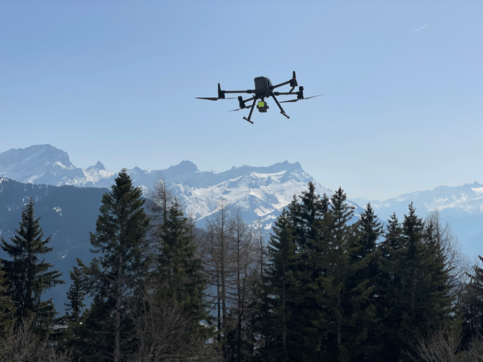
 A LiDAR mounted on a drone. Image Credit: EPFL/Topo.
However, the technology available to automate the mapping process is limited, making the procedure time-consuming and costly.
Switzerland is currently mapping its entire landscape using airborne laser scanners – the first time since 2000. But the process will take four to five years since the scanners have to fly at an altitude below 1 km if they are to collect data with sufficient detail and accuracy.
Jan Skaloud, Senior Scientist, Geodetic Engineering Laboratory (Topo), School of Architecture, Civil and Environmental Engineering, Ecole Polytechnique Fédérale De Lausanne
Skaloud added, “With our method, surveyors can send laser scanners as high as 5 km and still maintain accuracy. Our lasers are more sensitive and can beam light over a much wider area, making the process five times faster.”
Davide Cucci, a senior research associate at the Research Center for Statistics of the Geneva School of Economics and Management of the University of Geneva, who collaborates with Topo regularly, Jan Skaloud, and Aurélien Brun, lead author, a recent Master’s graduate from EPFL and winner of an award from the Western Switzerland Association of Surveyor Engineers, described the method in a paper published in the ISPRS Journal of Photogrammetry and Remote Sensing (IGSO).
Missing the Point
LiDAR laser scanners generate high-resolution digital twins, which are computer-based duplicates of things or landscapes that can be utilized in design, road systems, and manufacturing.
Lasers are very good at gathering spatial data since they do not require ambient light, can capture precise data over long distances, and can see through vegetation.
However, when lasers are installed on drones or other moving vehicles, their precision is typically compromised, particularly in regions with multiple obstructions, such as congested cities, subterranean infrastructure sites, and areas where GPS signals are disrupted.
This causes gaps and misalignments in the data points required to produce 3D maps (also known as laser-point clouds), which might cause scanned objects to appear twice. Before a map can be utilized, these mistakes must be manually fixed.
For now, there is no way to generate perfectly aligned 3D maps without a manual data-correction step. A lot of semi-automatic methods are being explored to overcome this problem, but ours has the advantage of resolving the issue directly at the scanner level, where measurements are taken, eliminating the need to subsequently make corrections. It is also fully software-driven, meaning it can be implemented quickly and seamlessly by end users.
Davide Cucci, Senior Research Associate, Research Center for Statistics of the Geneva School of Economics and Management, University of Geneva
On the Road to Automation
The Topo technique uses artificial intelligence to determine whether an item has been scanned several times from different perspectives. To fix gaps and misalignments in the laser-point cloud, the approach picks correspondences and puts them into a Dynamic Network.
“We are bringing more automation to 3D mapping technology, which will go a long way towards improving its efficiency and productivity and allow for a much wider range of applications”, stated Skaloud.
Journal Reference:
Brun, A., et al. (2021) Lidar point–to–point correspondences for rigorous registration of kinematic scanning in dynamic networks. ISPRS Journal of Photogrammetry and Remote Sensing. doi:10.1016/j.isprsjprs.2022.04.027.