Space-based light detection and ranging (LIDAR) and hyperspectral imaging are transforming Earth observation. These modern technologies enable scientists and engineers to analyze topography, vegetation structure, water quality, and mineral composition with remarkable precision.
When combined, they can provide a multidimensional perspective of the Earth's surface, structure, and materials. These technologies are crucial in addressing global issues such as climate change, disaster response, and sustainable resource management.
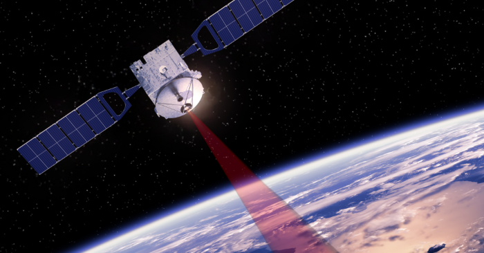
Space-based LIDAR. Image Credit: Avantier Inc.
What is Space-Based LIDAR?
Space-based LIDAR systems use laser pulses from satellites to determine the distance to the Earth's surface. The time delay of the returned signal offers exact elevation information.
NASA missions such as Global Ecosystem Dynamics Investigation (GEDI) and ICESat-2 use this technique to map 3D structures in forests, ice sheets, and topography.
Applications of Space-Based LIDAR
Space-based LIDAR has a wide range of applications. Some highlights include:
- Forestry and Biomass Estimation: Estimates canopy height and vertical structure for accurate carbon stock assessments and REDD+ activities.
- Topographic Mapping: Creates high-resolution Digital Elevation Models (DEMs) for remote regions.
- Ice Sheet Monitoring: Monitoring ice sheet elevations to determine melting rates and sea level rise.
- Urban Planning: Facilitates infrastructure design, flood modeling, and structural analysis for smart cities and catastrophe preparedness. LIDAR contributes to smart city programs by providing high-resolution data for infrastructure optimization, traffic management, and disaster resilience planning.
While LIDAR is excellent at mapping structure, hyperspectral imaging provides valuable insights into surface composition, making the two technologies very complimentary.
What is Hyperspectral Imaging?
Hyperspectral imaging involves acquiring data from hundreds of narrow, contiguous spectral bands.
Each pixel in an image has a full spectral signature, which allows materials to be identified based on their reflectance properties. NASA's Hyperion and the European Space Agency's PRISMA offer this data from orbit, providing insights on land, water, and atmospheric events.
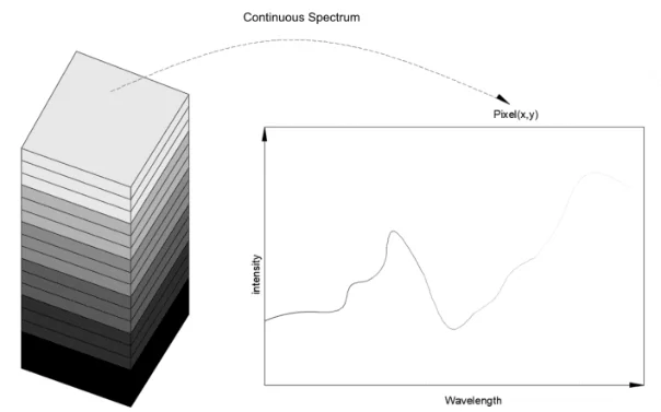
Hyperspectral imaging. Image Credit: Avantier Inc.
Applications of Hyperspectral Imaging
Hyperspectral imaging can be used in conjunction with LIDAR or by itself. Some of its applications are:
- Agriculture: Evaluates crop health, identifies nutritional deficits, and tracks disease outbreaks across fields. For example, hyperspectral imaging has been used to assess crop health during droughts in California, allowing for more targeted watering measures.
- Geology and Mining: Identifies minerals and lithologies for exploration and environmental monitoring.
- Water Quality Monitoring: Monitors water quality in rivers, lakes, and oceans, including silt loads, algae blooms, and chemical pollutants. Recent research have used hyperspectral imaging to monitor dangerous algal blooms in Lake Erie.
- Disaster Response: Maps natural disaster damage, including burned vegetation, flooded areas, and toxic contaminants.
Synergy Between LIDAR and Hyperspectral Imaging
The combination of LIDAR structural data and hyperspectral imaging compositional insights leads to a more thorough understanding of ecosystems and geophysical processes.
Below are three instances of synergistic applications:
- Wildfire Monitoring: Hyperspectral data detects burn intensity and plant regeneration, while LIDAR measures forest structure and fuel loads. For example, the 2023 California wildfires were investigated utilizing fused LIDAR and hyperspectral data to determine burn severity and direct replanting efforts.
- Flood Detection and Management: LIDAR maps elevation and water extent, while hyperspectral imaging assesses water quality and contaminants.
- Mapping Habitat and Biodiversity: LIDAR detects canopy gaps and terrain variance, while hyperspectral data identifies plant stress and diversity.
These methods promote precise conservation, sustainable resource use, and environmental risk reduction.
Manufacturing Challenges and Solutions
There are numerous significant hurdles to the development and deployment of space-based LIDAR and hyperspectral imaging systems:
- Miniaturization and Weight Reduction: Sensors for space missions must be compact and lightweight. Solution: Advanced materials such as carbon fiber composites and 3D printing help to reduce weight while maintaining structural integrity.
- Optical Precision and Calibration: Precise alignment and calibration are necessary for high sensor accuracy. Solution: AI-driven calibration and automatic alignment improve precision while reducing manual errors.
- Radiation Hardening: Space sensors need to be radiation-hardened to resist high levels. Solution: Radiation-resistant coatings and GaN semiconductors improve durability.
- Power Consumption and Thermal Management: Long-term space operation requires efficient power consumption and heat dissipation. Solution: Low-power electronics and passive cooling solutions increase efficiency.
- Data Processing and Transmission: Hyperspectral imaging generates large datasets that require efficient processing and transmission. Solution: AI-driven data compression and onboard edge computing improve bandwidth efficiency and processing speed.
Limitations of Space-Based Data
Aside from the issues outlined above, space-based LIDAR and hyperspectral imaging have following additional limitations.
- Atmospheric Interference: Atmospheric interference can alter measurements, necessitating complicated correction procedures.
- Spatial and Temporal Constraints: Predefined satellite orbits limit data coverage and resolution.
- High Cost and Technical Complexity: Developing and launching space-based sensors is still expensive, limiting access to well-funded groups.
- Data Overload and Processing Challenges: Processing large datasets from hyperspectral imaging might be challenging due to computational power requirements.
- Limited Sensor Lifespan: Self-healing materials may improve sensor endurance, but harsh space conditions may still destroy them over time.
Designing a space-based LIDAR/hyperspectral imaging system requires overcoming unique hurdles while remaining mindful of inherent constraints. This sophisticated technology is becoming more accessible year after year, and many of its limits may be reduced over time.
Prospects
The next generation of space-based remote sensing will rely significantly on more intelligent, automated systems. Advances are anticipated in:
- AI and Machine Learning: Enables rapid feature extraction, anomaly detection, and predictive modeling.
- Quantum Sensing: Provides high sensitivity for sensing minuscule changes in gravity, light, and magnetic fields. Quantum sensing detects gravitational anomalies with extraordinary sensitivity, paving the possibility for enhanced geological investigations from space.
- Smaller Satellites (CubeSats): Smaller satellites (CubeSats) offer inexpensive, frequent, and dispersed sensing capabilities.
- Data Fusion Platforms: Combine LIDAR, hyperspectral, SAR, and multispectral information for more actionable insights.
These developments advance the science of remote sensing and pave the way for business endeavors and public access to high-quality data.
Keys to Space-based LIDAR and Hyperspectral Imaging
A remote sensing revolution is underway, with space-based LIDAR and hyperspectral photography leading the way. Their integration, aided by AI, small satellite platforms, and new calibration methods, is revolutionizing how we monitor ecosystems, manage natural resources, and address global concerns.
To fully realize the potential of these technologies, additional research funding, international collaboration, and public-private partnerships will be required to shape a sustainable future for Earth observation.
As technology advances, these systems will become increasingly important for understanding - and protecting - our planet and beyond.
Avantier offers optical solutions for space-based optical communication and space-based quantum communication. Optimize your space projects with Avantier's high-performance optical solutions.
Key Takeaways for Space-Based LIDAR and Hyperspectral Imaging
- Technological Advancements: LIDAR technology provides precise 3D elevation data, while hyperspectral imaging records detailed spectral bands for material research.
- Complementary Insights: Combining LIDAR structural data with hyperspectral image material identification enhances understanding of environmental and geological processes.
- Commercial Applications: These technologies are widely used in agriculture, mining, forestry, water management, and urban planning.
- Future Innovations: AI, machine learning, and quantum sensing are revolutionizing the analysis and interpretation of remote sensing data.
- Challenges and Solutions: Engineering advancements address challenges such as sensor limitations, data processing, and environmental robustness in space.

This information has been sourced, reviewed, and adapted from materials provided by Avantier Inc.
For more information on this source, please visit Avantier Inc.