Optical Surfaces Ltd. reports how a motorised UV-Vis-NIR collimator and interferometric alignment system it supplied to the Deutsches Zentrum für Luft- und Raumfahrt (DLR) in Berlin, Germany has been used to set-up the ground breaking DLR Earth Sensing Imaging Spectrometer (DESIS).
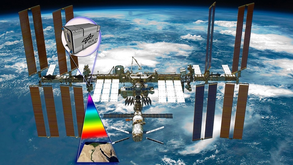
On 23 October 2019, DLR the renowned German Aerospace Center, and the U.S. company Teledyne Brown Engineering (TBE) announced the start of routine operations for DESIS on the International Space Station. Operated by DLR and TBE, DESIS is the most powerful hyperspectral Earth observation instrument in orbit and addresses a wide range of applications. Its high-resolution image data will enable the development of measures for environmental protection and support the more efficient, ecological use of agricultural land.
The hyperspectral Earth observation instrument provides images with a one-of-a-kind level of quality. The sensor system collects image data in 235 closely spaced spectral bands from on board the International Space Station (ISS), at an altitude of 400 kilometres. It has a ground resolution of 30 metres and a spectral resolution of 2.55 nanometres. This significantly increases the depth of information available in Earth observation data. The first images were acquired shortly after initial setup and DESIS data has already been used to identify plastic islands and oil slicks at sea. A few months ago, the high spatial resolution of DESIS made it possible to detect rare Earth elements from space for the first time.
By installing the motorised UV-Vis-NIR collimator and interferometric alignment system in our class 100,000 clean room we have been able to undertake diffraction limited broadband imaging for MTF measurement, focusing and geometric calibration of single optics and focal planes, fully integrated camera systems and hyperspectral imaging systems such as DESIS. To monitor and verify that the UV-Vis-NIR collimator system is consistently in alignment – Optical Surfaces also designed and supplied a software-operated Laser Unequal Pathlength Interferometer (LUPI) system to interface with the collimator system.
Ilse Sebastian, Calibration Engineer, DLR
For further information relating to high precision optical systems for space and aeronautic research please visit www.optisurf.com.