NASA, the European Space Agency, and the United Kingdom Space Agency are developing climate change research programs. Thermal imaging, a remote sensing technique, is commonly used in these studies to measure and analyze climate changes and reduce their impact.
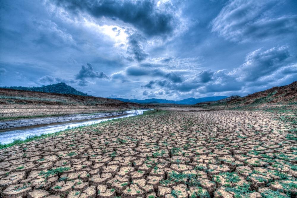
Image Credit: Siyapath/Shutterstock.com
The Extent of Climate Change
Climate change is globally impacting natural ecosystems and biodiversity. The current global warming trend is alarming as it proceeding at an unprecedented rate. Wind patterns, precipitation amounts, average temperatures, and severe weather events are all changing, putting human health, food, and water at risk.
Anthropogenic activities are to blame for these climate shifts. Carbon dioxide emissions are rapidly increasing, owing primarily to the combustion of fossil fuels. This is contributing to global warming, which has a direct impact on animals, humans, and the global ecological balance.
Natural disasters, such as melting glaciers, wildfires, more violent and frequent floods, storms, and heatwaves are the immediate environmental consequences of global warming. There have been recent extreme weather events, for example, wildfires in Australia and California and severe flooding in Germany, Belgium, and Australia.
Climate change is unquestionably affecting the entire earth, necessitating international collaboration to combat it. These issues emphasize the significance of the Paris Agreement target (IPCC 2018) to limit global warming.
The global climate has always been fluctuating. The average surface temperature of the planet is the most frequent metric for measuring climate change. Thermal imaging is a powerful remote sensing technology that has been used to study rising temperatures and climate changes. Thermal imaging data is taken in real-time from a number of platforms, including marine, land, and air-based vehicles, at the speed of light.
What is Thermal Imaging?
Thermal imaging is a method for collecting information about objects using infrared radiation and thermal energy to create images, even in poor visibility environments such as aerosols, fog, smoke, haze, and dust.
Thermal imaging technology has advanced over the years and includes a wide range of applications. It is particularly useful in climate change research because it is a completely passive technique capable of imaging both during the day and night. With its effective night-vision technology, it is especially capable of imaging in absolute darkness.
How Does Thermal Imaging Work?
The science of infrared energy (commonly known as ‘heat’), which is emitted by all things, is the foundation of thermal imaging. This energy is also known as an object's ‘heat signature’ and the amount of radiation released is proportional to the object's overall heat.
Thermal imagers or cameras have sensitive heat detection sensors that can detect minuscule temperature differences in objects. The object's infrared radiation is used to create an image based on temperature inflections and differences.
How is Thermal Imaging Used for Climate Change Research?
Thermal imaging is used in climate change research to observe environmental changes and predict their consequences.
Infrared detectors integrated into a satellite's electronic devices monitor the Earth's surface, detect radiation produced by surfaces, and translate that information into images or scientific data that is fed into statistical models to predict trends and climate changes.
Thermal imaging has a wide range of applications in climate change research. The primary use of thermal imaging in climate change research is as follows:
CO2 emissions
The monitoring of CO2 emissions in the atmosphere, which identifies the mechanism that drives climate change, is the most important application of this technology. The first European mission to measure CO2 sinks and sources, which is the main component of global warming, is set to launch in 2022. MicroCarb is the name of the mission, and an infrared detector is installed into the satellite to monitor CO2 levels in the atmosphere.
Fire
Infrared integrated satellite detects all kinds of fire, including small and new wildfires.
Finding wildfires early in the process helps to prevent catastrophic wildfire events and reduce their impacts.
Ecosystem Spaceborne Thermal Radiometer Experiment on Space Station (ECOSTRESS) is a NASA-launched mission that has high-resolution satellite sensors that sharply capture small fires.
Monitor water resources
Water resources such as coastal and inland water, as well as snow cover and ice conditions, are monitored using thermal imaging and remote sensing technology.
Infrared photos are recorded to assess and analyze ice conditions in real-time, as well as publish ice conditions for lakes and rivers that are used and benefited by the local population. In the long run, this data will aid the study of climate change and its implications for agriculture and land use.
Urban heat
The heat created by a large metropolis can exacerbate the health risks of heatwaves, particularly for the city's elderly and children.
This information is captured using thermal imaging techniques which are then utilized to determine which communities are the most affected by heat and which mitigation strategies are highly effective. These statistics could aid a city's assessment of mitigation strategies' relative efficiency.
Volcano eruption
Images of volcanic eruptions were captured by NASA's Advanced Spaceborne Thermal Emission and Reflection Radiometer (ASTER). This information is used to create mitigation techniques to lessen the impact.
ECOSTRESS (Ecosystem Spaceborne Thermal Radiometer Experiment on Space Station) has the same ability to record images of volcanic eruptions as ASTER, but it can capture new hotspots and cracks earlier than ASTER.
New Research and Future Outlooks of Thermal Imaging
New climate change research employing thermal imaging technology is proposed as part of the Paris Agreement climate target, including the MicroCrab mission, which aims to monitor CO2 levels in the atmosphere to identify cities that are major emitters.
The European Space Agency is preparing six new missions employing infrared imaging technology as part of the European Copernicus Earth Observation Programme to find solutions to the difficulties posed by climate change.
References and Further Reading
Allen, M. R., Babiker, M., Chen, Y., Coninck, H. D., Connors, S., Diemen, R. V., Dube, O. P., Ebi, K. L., Engelbrecht, F., Ferrat, M., Ford, J., Forster, P., Fuss, S., Guillén, B. T., Harold, J., Hoegh-Guldberg, O., Hourcade, J-C., Huppmann, D., Jacob, D., ... Zickfeld, K. (2018). Summary for Policymakers. In Global Warming of 1.5: An IPCC Special Report on the impacts of global warming of 1.5\C above pre-industrial levels and related global greenhouse gas emission pathways, in the context of strengthening the global response to the threat of climate change, sustainable development, and efforts to eradicate poverty. IPCC. https://www.ipcc.ch/sr15/chapter/spm/
Klingelhöfer, D., Müller, R., Braun, M. et al. Climate change: Does international research fulfill global demands and necessities?. Environ Sci Eur 32, 137 (2020). https://doi.org/10.1186/s12302-020-00419-1
Janet L., Subashini P., William M. (2012) Monitoring winter ice conditions using thermal imaging cameras equipped with infrared microbolometer sensors, Procedia Computer Science, Volume 10, 1158-1165. https://doi.org/10.1016/j.procs.2012.06.166
UK Space Agency. (2021) Space data helping Earth adapt to challenges of climate change. [Online] GOV.UK. Available at https://www.gov.uk/government/news/space-data-helping-earth-adapt-to-challenges-of-climate-change
Steve Cole and Joshua Buck [Online] NASA launches new era of Earth science from space station. [Online] NASA. Available at https://climate.nasa.gov/news/1156/nasa-launches-new-era-of-earth-science-from-space-station/
UK Space Agency. (2021) Microcarb. [Online] GOV.UK. Available at https://www.gov.uk/government/case-studies/microcarb
DLR. (2020) Six new missions for the European Copernicus Earth observation programme. [Online] Available at https://www.dlr.de/de.
Disclaimer: The views expressed here are those of the author expressed in their private capacity and do not necessarily represent the views of AZoM.com Limited T/A AZoNetwork the owner and operator of this website. This disclaimer forms part of the Terms and conditions of use of this website.